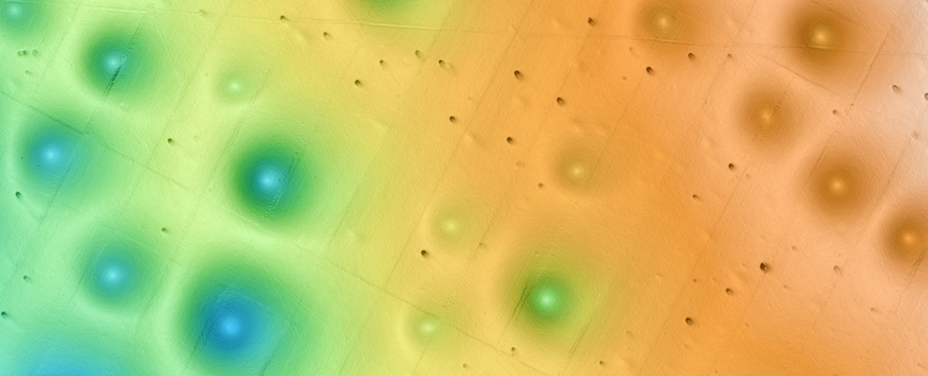
Off the coast of Big Sur, California, beneath the waves, lies a mysterious landscape marked by large holes in the clay and sand. Decades after their discovery, a new study published in the Journal of Geophysical Research Earth Surface has uncovered the curious pattern that explains the circles.
The most common theory suggests that the marks on the ocean floor are the result of methane gases or hot fluids emerging from the Earth's interior, displacing fine sediments. However, while this may be true in some parts of the world, it is not always the case, reports Science Alert.
On a recent expedition to the Sur holes, which are located at a depth of 500 to 1500 meters, an underwater robot operated by researchers from MBARI (Monterey Bay Aquarium Research Institute) found "little evidence" of methane venting or other fluid flows. Instead, the team believes that the pockmarks probably formed due to gravity.

The large prints are located on a continental slope, and samples of the seabed collected by the robot suggest that sediment has flowed down this slope intermittently over the last 280,000 years. The last major flow occurred 14,000 years ago, possibly due to an earthquake or slope collapse.
The researchers argue that such events could lead to erosion in the center of each hole. When a sufficient amount of sediment flows down the slope, it could cause "enough erosion" to carve a wider hole, shifting the edges of "multiple holes tens of kilometers apart", the team proposes.
This could explain why the marks appear in "chains", although more studies are needed to confirm this idea. Recently, it was discovered that small holes in a similar field in the North Sea are created by porpoises and eels.
The seabed is often described as Earth's last frontier. The race is on to explore this alien world, not only out of scientific curiosity, but also for the viability of new industries such as offshore wind energy or seabed mining.


